
used with permission http://tvl1.geo.uc.edu/ice/Glacier.html
Holgate Glacier, Kenai Peninsula, Alaska

Nearly 2% of the water on the earth is currently tied up in glaciers.
There are two type of glaciers. They are

A "cool" dude standing where he shouldn't be. Many glacial hikers die each year falling into crevasses. Notice how dirty the ice actually is.

Yosemite Valley (Hey lady .. get out of my picture!)
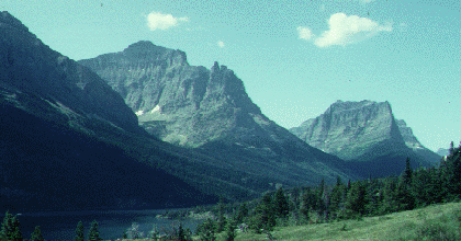
Permission from http://www.geology.iastate.edu/new_100/hanging.html Hanging Valleys on the east side of Glacier National Park |
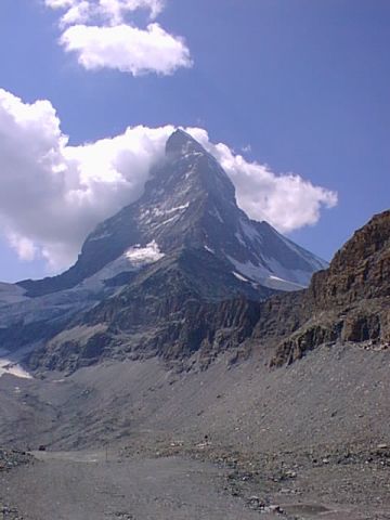
with permission from Mad about Mountains by Ann Bowker The Matterhorn |
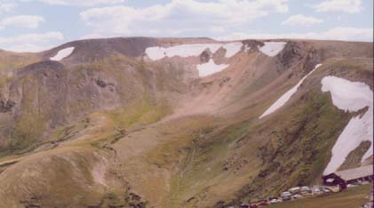
A Cirque seen close up (Rocky Mountains)
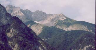
Cirque (sir ... rhymes with jerk) in Austria
Notice the sharp ridge (in front) called an arête "a rett"
which is French for fish bone (I think)

These Striations are grooves in bedrock caused by glacial grinding (Colorado). The ice doesn't do this, it is the rocks within the ice that do the grinding. |
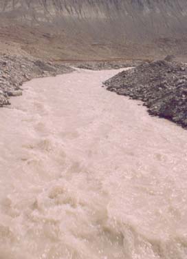 This glacial run-off looks white because it contains ground-up rock called "glacial flour". When it settles, it looks like a fine powder. Jasper National Park, Canada |
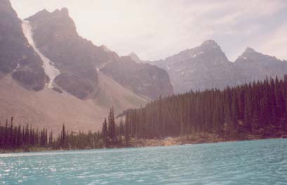
Moraine Lake (the most beautiful place on the earth) Jasper, Canada. Notice the loose sediments at the base of the mountain. This is called talus which (in this case) is mostly from glacial action. |
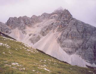
More Talus (Austria) |
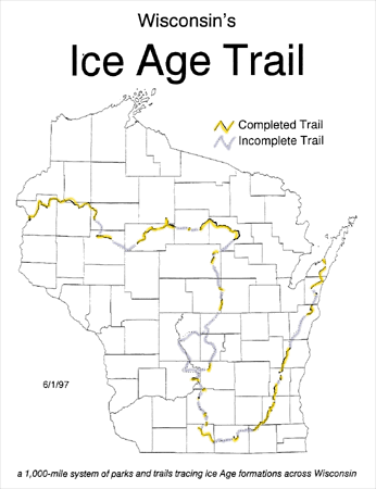
Permission from iceagetrail.org
This map outlines the terminus of the last glacial advance. It is interesting to note that all of Wisconsin was NOT glaciated. In fact, the entire South-West sector of the state remained glacier free - known as the "driftless region". This is because the advancing glacier hit bedrock which was very resistant and acted like a "wedge" which split the glacier into separate "lobes". At least that is the prevailing hypothesis.
This occurred about 12,000 years ago.
All along this trail, several glacial features may be found.
Kettle Moraine Area - Waukesha County (and surrounding counties to the north and south) glacial area formed by the Green Bay Lobe and Lake Michigan Lobe. It includes moraines, drumlins, kames, eskers, and kettles.
Devil's Lake State Park is a glacial dammed lake and Parfrey's Glen is a canyon which exposes much of the underlying rocks on the south end of the Baraboo range.
This area is where a huge deposit of ancient red quartzite was exposed to the surface. It tells us of a time 1.7 billion years ago that this area was at a continental margin and there was sand all over (and got buried to eventually form the quartzite). The glacier helped expose this rock to the surface. Here is a very good geology history lesson about the area.
As a glacier moves it sculpts the landscape. In addition, the water
that melts off a glacier can do the same. The term drift refers to
sediment structures left by glacial action, no matter how it was done.
Moraines - A ridge like accumulation of till built chiefly along the terminal margin of a valley glacier or the margin of an ice sheet.
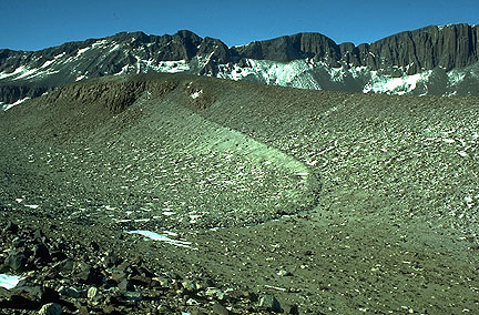
permission from http://tvl1.geo.uc.edu/ice/Image/icland/organ.htmlExample of a Moraine
Kettles - depressions left by blocks of ice trapped in glacial deposits. When the ice melts it leaves a depression. Many of the lakes in Wisconsin and Minnesota are formed from kettles.

permission from http://tvl1.geo.uc.edu/ice/Image/icpro/643-17.htmlDrumlins - Cigar shaped mounds which point in the direction the glacier moved. It is not known exactly how they are formed but most likely as a result of a glacier running over a pre-existing glacial deposit.

The Mihal household which sits smack dab on top of a drumlin. Way cool!
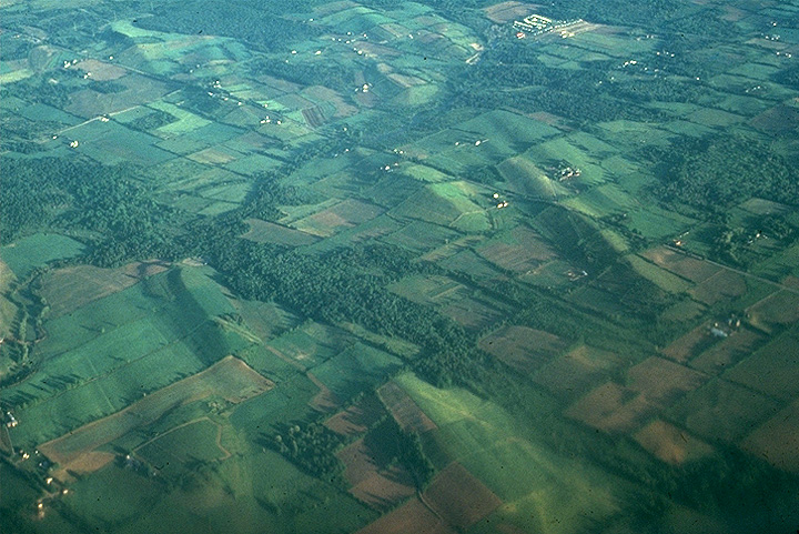
Permission http://www.geo.cornell.edu/geology/classes/Geo101/101images.html
click here
Want to see more drumlins? Go peddle your bike on the Glacial - Drumlin State Bike Trail
Kames - Stratified drift deposited in depressions and cavities in stagnant ice and left as steep sided hills when the ice melts. For example, imagine water running on the top of a glacier but suddenly runs down a deep crevasse ... this would be a place where lots of debris could pile up. Holy Hill, Lapham Peak, and Dundee Kame are local examples.
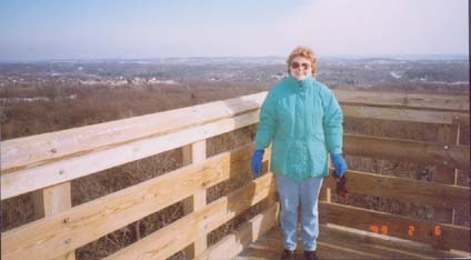
View from Lapham Peak Waukesha WI ( a great place for hiking &
X-country skiing)
Just south of I94 exit hwy. C. Who is that sexy lady?
Esker- A winding ridge of stratified drift (mostly sand and gravel). This feature is formed in a glacial tunnel when ice is melting and carrying lots of sediments with the running water. When the ice is all gone you get a ridge of sediments up to 15 m high and kilometers in length. If you live on one of these you may be rich because sand and gravel are valuable building materials

permission from http://tvl1.geo.uc.edu/ice/Image/subland/Bearflute.html
Erratics
- A stone or boulder, glacially transported from place of origin and left
in an area of different bedrock composition. Some erratics have been moved
hundreds ... even thousands of miles. As you drive past a farmers field,
look for some huge boulders which look out of place and were too big for the
farmer to move ... these are usually erratics.
Great glacier links:
http://www.geo.cornell.edu/geology/classes/Geo101/101images.html
ŠJim Mihal 2004, 2006 - all rights reserved