The Hydrologic (water) Cycle
Water is constantly being evaporated (mostly from the oceans) into the atmosphere by solar energy. Winds transport some of the water vapor in the air over the land (also driven by solar energy). When the water vapor produces rain, the water then has to find its way back to the ocean (the ultimate base level). During this trip back to the ocean, the water can do some wild things to the earth's surface.
Links:
http://ww2010.atmos.uiuc.edu/(Gh)/guides/mtr/hyd/home.rxml
http://grads.iges.org/nncc/hydro.html
Stream Erosion
The amount of material a stream carries depends on:
Youthful Phase
Consider a landscape which has just been uplifted - this
is a "youthful" landscape. It is marked by mountains with steep slopes,
waterfalls, and rapids.
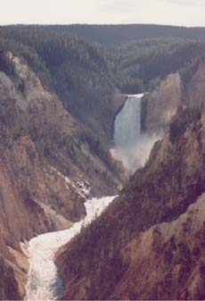
Yellowstone Falls |

Alps (Austria) |
Water will weather steep "V" shaped valleys in this phase. Water weathering is vertical ... rapid down cutting is evident. The Grand Canyon is a good example of this "youthful" phase (even through the Grand Canyon is quite old chronologically).
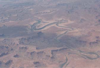
Arial view of the Colorado River
Mature Phase

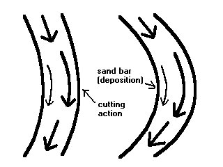
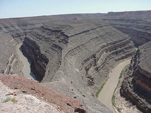
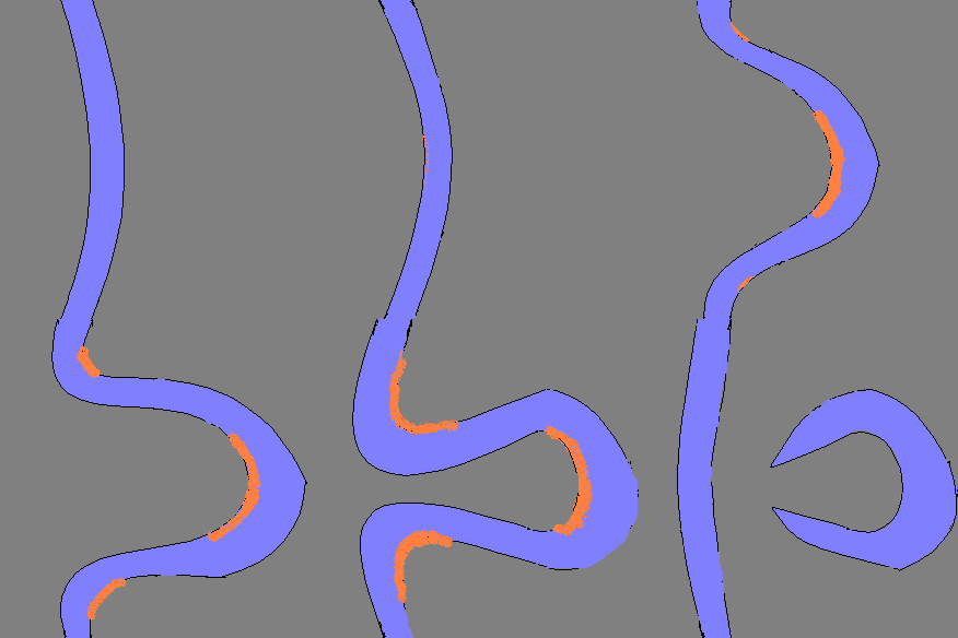
In time, running water will effect its toll on the landscape. It eventually carves out broad valleys. The weathering power of the river is changed from vertical to horizontal as the river starts to meander (moves in curves). This is because water (and the material it carries) always "cut" at the outside bank of a river (where the motion is fastest) ... and deposits sediments at the calmer inside bank of the river. This action tends to extend the meander and widen the valley.
Old Age
This landscape occurs when a stream has cut out a wide floodplain. It often is found at the mouth of the river (where it meets the sea) and there is a very gentle gradient (slope). The lower sections of the Mississippi River exhibit this profile. This is where a river can be quite dangerous during times of excessive rainfall/snow melt because it can easily overflow its banks. In fact, one should not consider flooding as a freak occurrence but rather, an inevitable consequence in the region.
Features of the region:
 (animation)
As the river meanders it will naturally create an extreme "bow" which will eventually be "cut off", leaving an oxbow lake. The lower Mississippi has hundreds of these features along its banks. Since the 1930's, the Army Corp. of Engineers has created several artificial cutoffs in an attempt to speed up the river (to reduce flooding).
Click
here
to see a Yahoo map of the lower Mississippi (zoom in once and follow the river
to see the many places the river has changed direction)
Click
here
to see the Nile delta
Click
here
to see New Orleans
Click
here
to see the Atchafalaya River Delta, Louisiana
permission from NASA
In some instances, a river in its "old age" stages can be rejuvenated due to uplifting. Thus the river (working with a new steeper gradient) enters a "youthful" phase again and reverts to cutting sharp "V" shaped valley walls. Instances of this have occurred on the upper Mississippi due to a gradual uplift caused by the "recent" loss of thick ice sheets that are no longer present (the ground moves up just like a pillow does when you move off of it). This is called a rejuvenated stream.
Slow vs. Fast
River erosion can affect the landscape in a "slow but steady" time scale (the Grand Canyon) or in an "all at once" flooding event. The "slow and steady" erosion at the surface may take several lifetimes to make any noticeable change in the landscape, but in the long run, produces the greatest overall effect. We tend to notice the less frequent but sudden events which make an impact on the surface but not to the same degree. A good analogy occurs when you talk about human deaths. One tragic event can make headlines in the newspapers for weeks (we will all remember 9-11 for the rest of our lives) ... but if you look at the obituaries in the paper, you will see that far more people die every day as a result of old age or illness. Slow and steady far outnumbers the few and infrequent "events".
Some cataclysmic "events" in the history of the earth are worth note. Probably the greatest flooding event occurred when Lake Missoula (a former glacier-fed lake in S.W. Canada 12,000-15,000 years ago) broke its ice dam and suddenly released a wall of water (estimated at 60 times the current discharge of the Amazon) into present Montana, Washington, Idaho, and Oregon. This event repeated itself perhaps up to 100 times during the last ice age. These events sculpted the terrain in the blink of an eye.
Also, sections of the Grand Canyon were plugged by lava flows. These flows created natural dams which eventually broke .... sending enormous volumes of water through the canyon. These blasts of water sculpted sections of the canyon in an instant.
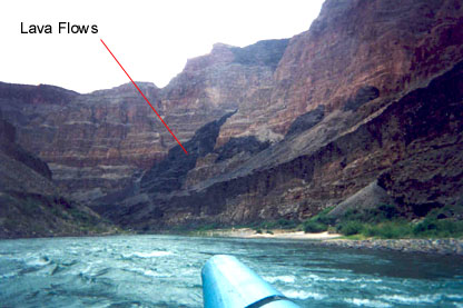
Photo by Barb Wallner
Sometimes when "All Hell Breaks Loose" you get a sudden sculpting of the earth's surface. Geologists give names to these devastating events - such as Debris Flows, Mudflows, Jökulhlaups (pronounced "yo-kul-h-loip"), and Lahars. They can be initiated by any of the following:
©Jim Mihal 2004, 2006 - all rights reserved